The Heatwaves of 2022
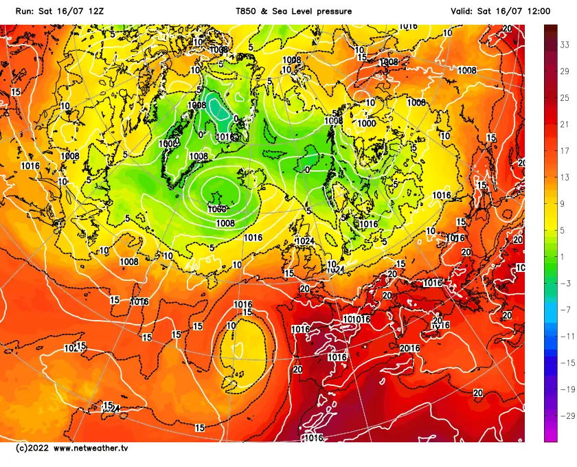
The Heatwave of July 16th to the 19th
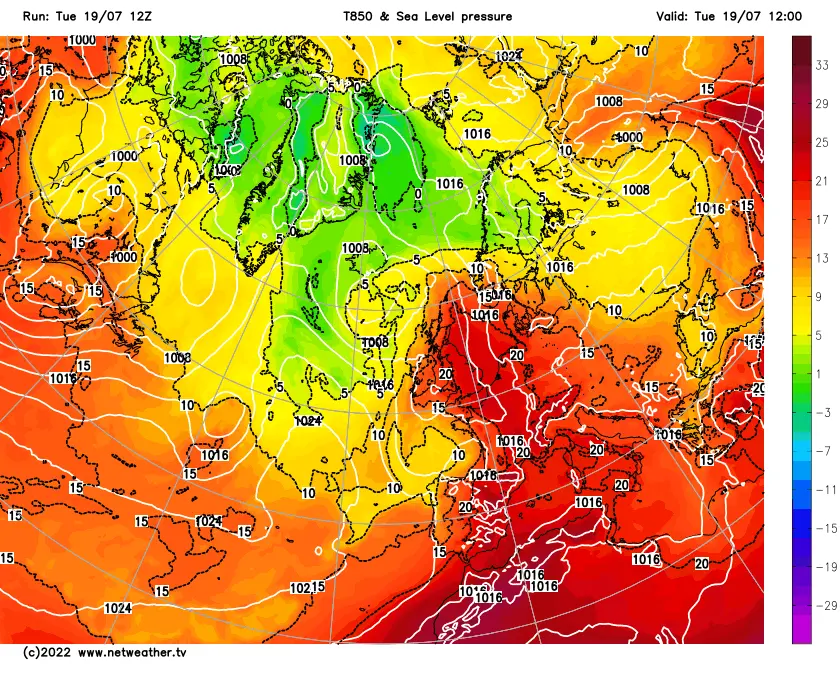
From the 16th to 20th England and later Wales and southern Scotland experienced a short but extremely hot heatwave which smashed previous heat records.
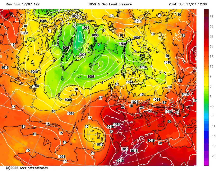
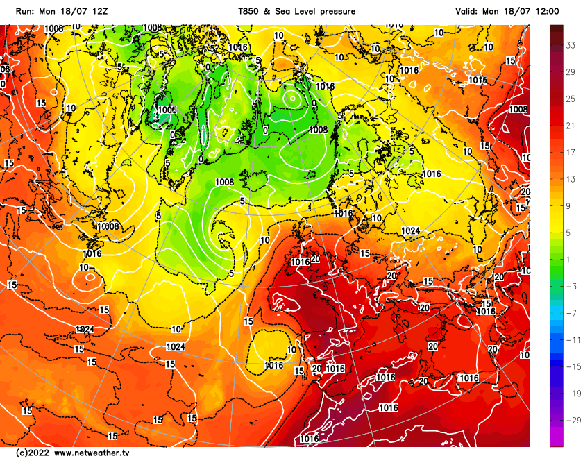
The 16th saw high pressure become centred over the UK with low pressure to the north west and a cut off low to the west of Portugal. The set up allowed the first hot air to push towards and into the UK with a 850pha of 10C to 15C. This resulted in temperatures in Sheffield to reach 26C which isn't anything out of the ordinary. At the time very hot air was based over Portugal brought in from North Africa and as the high pressure drifted westward this allowed the even hotter air to push northwards into the UK. On the 17th temperatures reached 29.5C degrees very hot but still not crazy temperatures. The night time low wasn't too bad at 14.2C. The cut off low was now edging towards the UK and this allowed even warmer 850 to push into the UK with 15 to 20C air arriving. This allowed the temperatures to rise even further on the 18th setting a new record 35.7C beating the previous record from 2019 by 0.5C. The overnight low for the 18th was 19.3C. However this hid part of the story as an inversion occurred during the night where the air was warmer the higher up you went. The inversion made temperatures on higher ground rise back towards 25C. The cut low was now crossing the country bringing with an airmass with 23C at HPA level. Tuesday morning saw the temperatures at 25.8C at 06:00 hrs. This fell back slightly but temperatures quickly started to rocket as any cloud quickly disappeared and the country was in the oven. Colder air was to the west but this was only making very slow progress westward. Midday saw the old record of less than a day beaten and then it was a case of how high it would go finally reaching 38.8C by three o'clock. Western park recorded 39.4C.
Soon after 16:00 hrs the cooler air arrived as the cold front and cloud arrived from the west and a rapid drop in temperature followed and by 20:00hrs it was a cool feeling 30C. Although cooler the air was still warm enough to allow 25C to be reached the next day but by the record heat wave was over and every one was trying to get the heat out of the houses. In eastern England and the south east 40C was exceeded with a new record of 40.3C being set at Coninsby, 40.2C being set at St James Park and Heathrow airport. 40.1C at Gringley on the hill and Kew Gardens and 40C at Northbolt. Scotland recorded it's hottest day at 35.1C at Floors Castle. Wales saw it's highest temperature the day before as 27.1C was reached at Hawarden. Night time temperatures. Night time temperatures at Emly moor and Kenley airport didn't fall below 25.8C.
The heatwave had 46 stations exceeding the previous record 38.7C and seven passing 40C. Only two previous days had breached 38C and that's 25th of July 2019 and the 10Th of August 2003. Records are normally only broken by a few tenths of degree but this time they were being beaten by up to 1.6C and our case by 3.1C from the record the day before. The heat was also UK wide and the average maximum temperature exceeding 30C for the first time. See the pdf from the met office for more details.
Nationally grass fires broke out destroying houses in London and in South Yorkshire. Id the heat wave had continued for three or more days more fires would have broken out leaving the fire service over run. Worryingly this hasn't caught the attention of our leaders so if heat and drought become common place a larger loss of life from fires is very possible. There needs to an re-think on housing to make sure houses can keep heat out as well as in and better planning needs to be made to make sure the urban heat island isn't amplified further. Climate change will again focus on emissions but we need to look at population growth and our effect on natural resources as well otherwise nature will try and correct it for us as it's already doing. At the present time the future doesn't look good for humanity and the rest of the planets wild life and plant life.
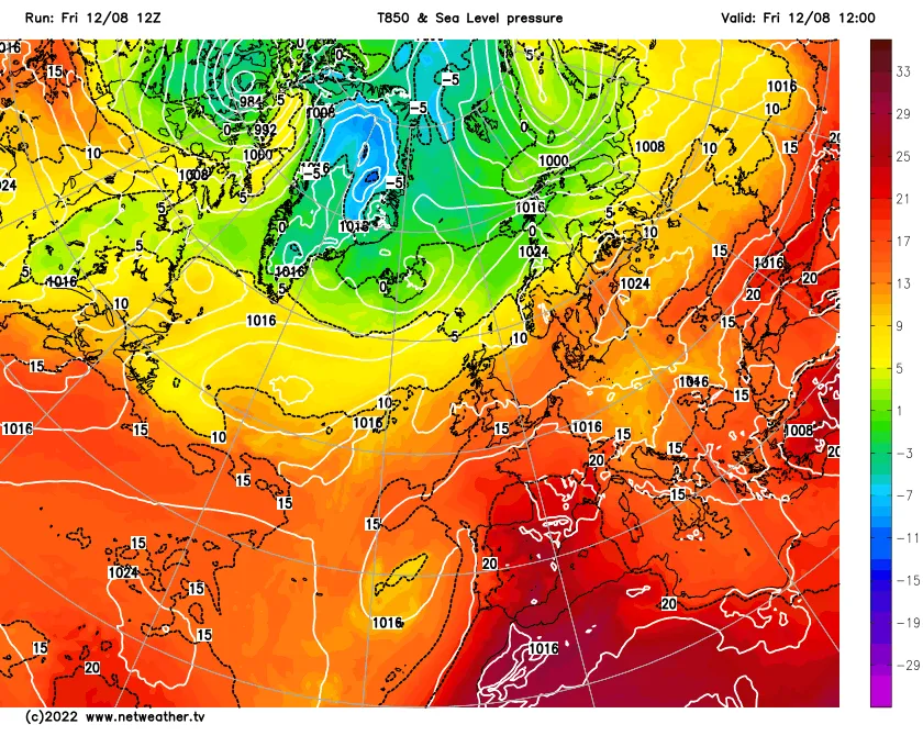
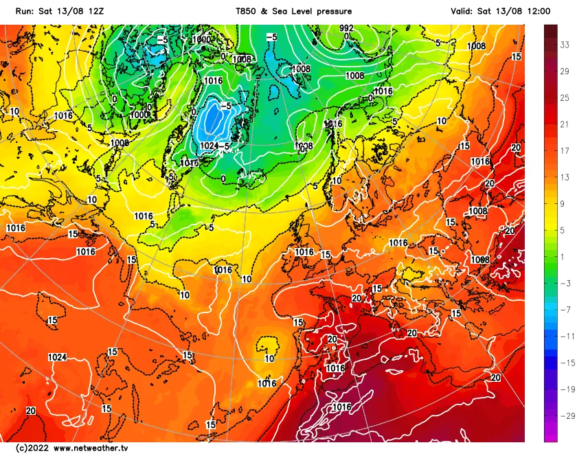
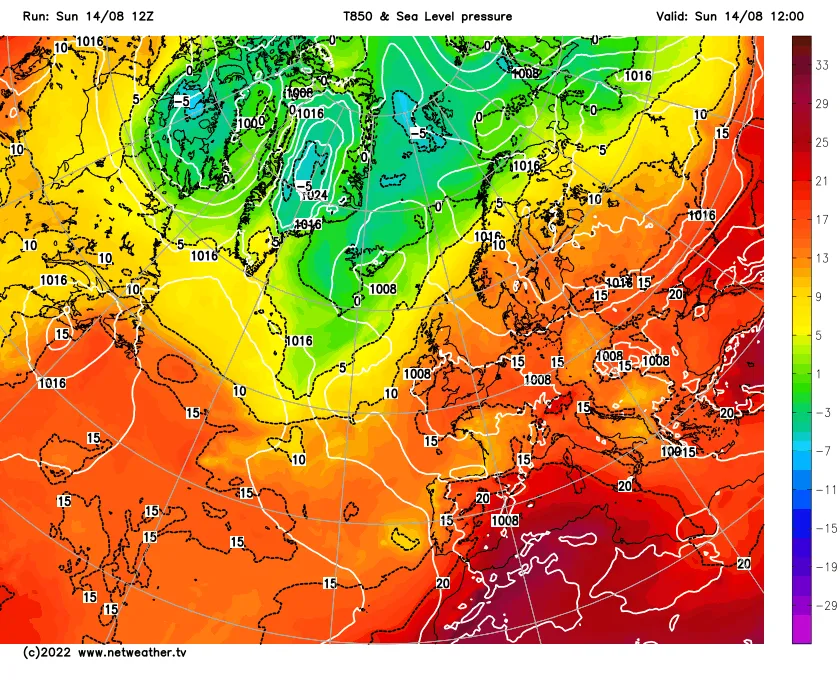
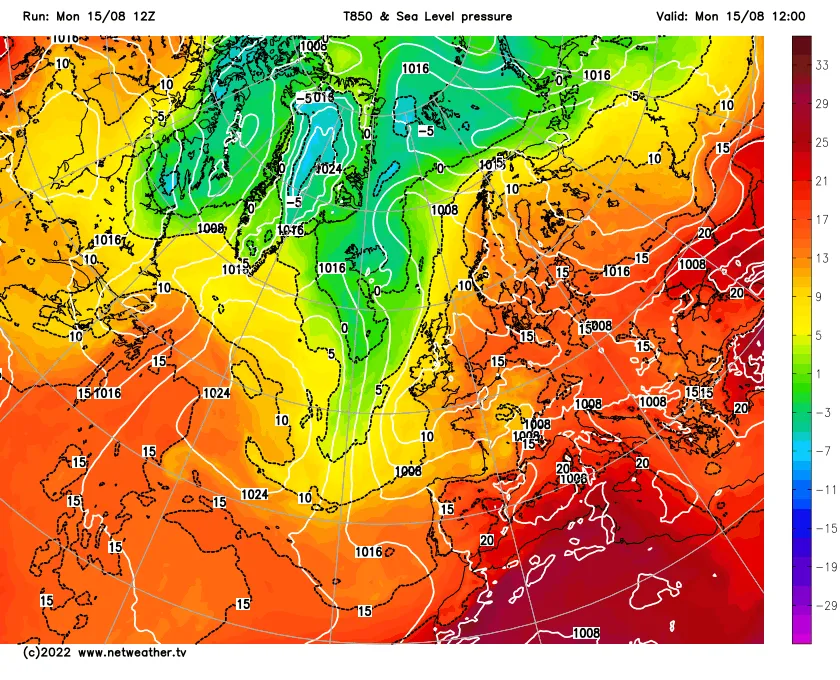
The Pictures below show the heatwave developed and progressed
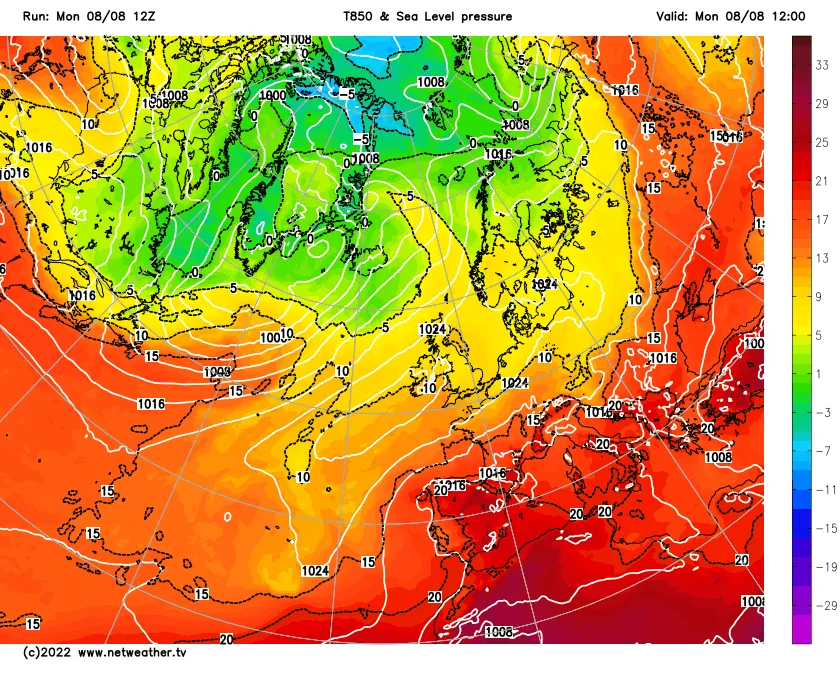
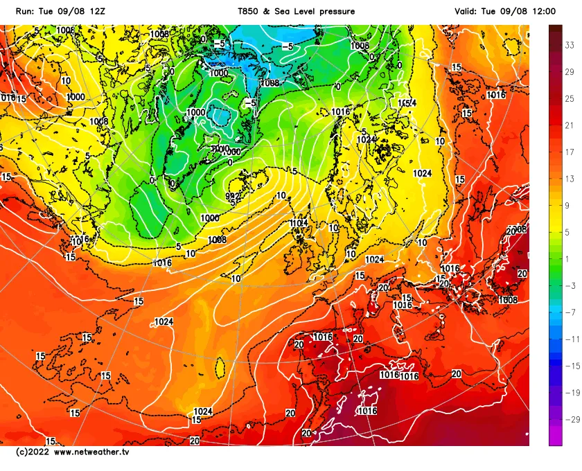
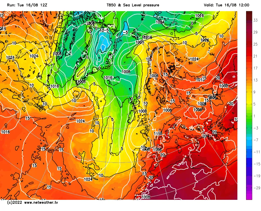
The heatwave of August 8th to the 16th of August 2022
After the intense heatwave in July the country didn't need another one however as a high pressure centred over the UK drifted eastward we once again tapped into very hot air over Europe. It took a while for the met Office to announce the coming heatwave predicted very well by the GFS but finally an extreme heat warning was issued on the 9th lasting to the 14th. The heatwave was less intense as the July heatwave, however lasted longer featuring five consecutive days above 30C
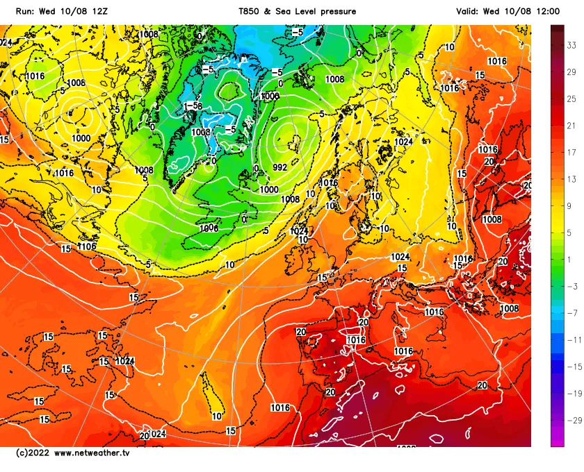
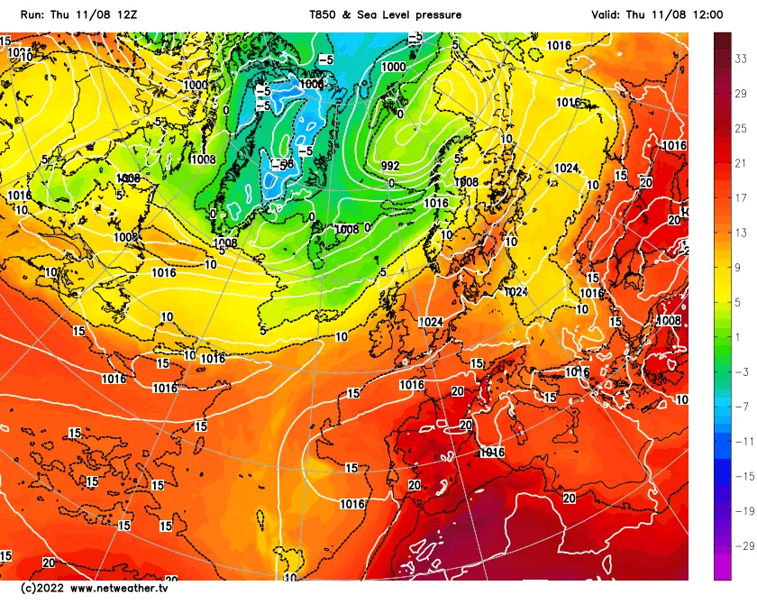
The heatwave started with a slow build of heat. 26.3C was recorded on the 8th 27.4C on the 9th. temperatures jumped 30.2C on the 10th. The peak of the heat in Sheffield was on the 11th and the 14thwhen 31.5C was reached. Close to but not breaking the August 2003 record of 31.6C. Nigh time temperatures were on the warm to very warm side but generally low enough to allow a goods night sleep unlike the previous heatwave. This may also be the reason why thee record didn't fall. The 12th and 13th recorded 31.1C and 30.8C. Cooler air arrived on the 15th but it was still hot as temperatures peaked at 26.7C.
Unlike the previous heatwave storms did accompany the break down of the heatwave on the 16th as a complex area of low pressure moved North from France across the UK. Thunder and lightning wise the storm was weak however rainfall wise it wasn't with 49.4mm falling mostly in the first couple of hours as the rain continued overnight. This was the 6th wettest 24 hours since 1989 and caused flooding in parts of Sheffield as the combination of poor highway drainage maintenance by the council and the shear amount of rain falling overwhelmed the local drainage. This was mostly in the south of Sheffield which saw the heaviest of the rainfall. Temperatures returned to normal and one hopes we don't see a repeat of such sustained heat for a while.
Nationally the highest recorded 34.2C at Wigginholt on the 11th while 34.1C was recorded at Charley on the 14th. The heatwave caused numerous wild fire breakouts from the 8th to the 14th. The combination of drought and heat caused a 200% increase of wild fires from the previous year.